9 min read / Bikal Shrestha & TrekGuard Team /
The Annapurna Circuit and the Road: How Much Trail Is Actually Left
The jeep road now reaches Manang on one side and Muktinath on the other. Measured leg by leg against our 14-day itinerary, here is how many kilometres have a road beside them, which 31 km cannot be driven, and the acclimatization cost of jeeping past the start.
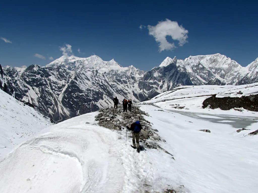
Photo: Adventure pulse trekkers / CC BY 4.0
Quick Summary
TL;DR - Key Takeaways
- The motor road now runs from Besisahar to Manang and continues toward Khangsar. On the western side it is established from Muktinath down through Jomsom and the Kali Gandaki valley to Tatopani and Beni.
- Measured against the 180 km of point-to-point walking in our 14-day itinerary, 76 km on the Besisahar side and 42 km between Muktinath and Tatopani now have a road in the same corridor.
- The 31 km from Manang over Thorong La to Muktinath has no road and cannot get one. That section holds the pass at 5,416 m and it is the reason the circuit still exists as a trek.
- The NATT waymarked foot trails run parallel to the road for much of the Manang side, so a road in the valley does not mean you are walking on it. Red-and-white markers are the main route, blue-and-white the side trips.
- The real cost of jeeping in is not scenery, it is acclimatization. Driving Besisahar to Manang moves your sleeping altitude from 760 m to 3,540 m in a single day, replacing five nights of graded gain.
What the Road Reaches Today
The question people actually type into a search box is some version of "is the Annapurna Circuit ruined". It deserves a measured answer rather than an opinion, so here is the road, stated plainly.
Eastern side. The motorable jeep track runs from Besisahar all the way to Manang, and extends beyond it toward Khangsar. A stretch that once took five to seven days on foot can be driven in roughly seven to ten hours. The intermediate road head at Chame, the district headquarters, sits about 63 km from Besisahar and is commonly reached in four to five hours.
Western side. The road is fully established from Muktinath down to Jomsom, and continues through the Kali Gandaki valley to Tatopani and on to Beni. The walking route between Muktinath and Jomsom now follows the motor road itself, which is why so many trekkers take a jeep or a flight out of Jomsom rather than walking that stretch.
Both of those statements were true in some partial form ten years ago and are more true every season. Road building in Manang and Mustang is not a rumour to be checked before you go. It is finished infrastructure in most of the valley.
The Circuit, Measured Leg by Leg
Below is our Annapurna Circuit itinerary broken into four blocks, with the walking distance of each and its road status. The distances are the point-to-point legs of the 14-day schedule and total 180 km. The acclimatization day at Manang, a 6 km out-and-back hike, is excluded because it does not move you along the route.
One number is worth sitting with. The block that is genuinely untouched is 31 km, a little over a sixth of the walking.
| Block | Legs | Distance | Share of walking | Road status |
|---|---|---|---|---|
| Besisahar to Manang | Days 1-5 | 76 km | 42% | Jeep road in the corridor; NATT foot trails run parallel for much of it |
| Manang to Muktinath over Thorong La | Days 7-9 | 31 km | 17% | No road. Foot and pack animal only |
| Muktinath to Tatopani | Days 10-11 | 42 km | 23% | Motor road; the walking route largely follows it |
| Tatopani to Ghorepani to Nayapul | Days 12-13 | 31 km | 17% | Poon Hill foot trail; a separate trek that many now skip |
The 31 km That Cannot Be Driven
Everything the circuit is famous for lives in that 31 km block, and it is worth naming what is in it.
You leave Manang at 3,540 m, sleep at Yak Kharka at 4,110 m and then at Thorong Phedi at 4,450 m, cross Thorong La at 5,416 m and drop to Muktinath at 3,760 m. The pass day alone is 15 km and around eight hours, with 966 m of climbing to the pass and 1,656 m of descent on the far side.
That terrain is not going to carry a road. The pass is a high snow saddle between the Annapurna and Damodar ranges, closed by snow for part of the year, and the approach from Thorong Phedi is a steep switchback climb. Whatever else happens in the valley, the crossing itself stays a walk.
This is the honest core of the answer to "is it ruined". The circuit as a three-week walk through five climate zones with the road nowhere in sight is over. The circuit as a high pass crossing with a serious approach is intact and unchanged. Which of those two things you were coming for determines whether the road ruined it.
A Road in the Valley Is Not the Trail You Walk
The most common mistake in this debate is treating a road on the map as a road under your boots. On the Manang side, for a good part of the distance, they are different lines.
The Natural Annapurna Trekking Trail, usually shortened to NATT, is a network of waymarked foot paths built specifically to keep trekkers off the motor road. The markers are colour coded: red and white for the main walking route, blue and white for scenic side trips. Where a NATT alternative exists, it is generally the better walk as well as the quieter one.
The sections worth knowing:
Tal to Karte to Dharapani. Crosses to the far bank on suspension bridges and avoids the west bank road entirely.
Upper Pisang to Ghyaru to Ngawal. Climbs to around 3,700 m through high stone villages the road simply bypasses. This is also the better acclimatization line, because it gains and loses altitude rather than contouring, and our itinerary routes through Upper Pisang for that reason.
Side trails from Manang. The Praken Gompa hike and Kicho Tal, the ice lake, at around 4,600 m. These are the classic acclimatization walks for the Manang rest day.
Tilicho Lake. A road-free two-day detour reaching 4,919 m, and the single best addition to the route if you have the days for it.
None of this un-builds the road. What it does is change the accurate statement from "42% of the eastern walk is on a road" to "42% of the eastern walk has a road in the same valley, and a marked foot alternative exists for much of it".
Jeeping In Is an Altitude Decision, Not a Time Decision
Almost every trekker now shortens the eastern approach, and almost every discussion of it is about dust, scenery and saved days. The part that gets left out is the one that can end your trek.
Walked, the first five days of the itinerary raise your sleeping altitude in graded steps: Jagat at 1,300 m, Dharapani at 1,860 m, Chame at 2,670 m, Upper Pisang at 3,300 m, Manang at 3,540 m. That is five nights spent moving from 760 m to 3,540 m, and it is doing quiet, unglamorous work on your blood chemistry the whole time.
Driven, the same gain happens between breakfast and dinner.
Besisahar to Manang by jeep is a sleeping-altitude change of 2,780 m in one day. Against a guideline of no more than 500 m of sleeping gain per night above 3,000 m, and at least two days to reach a sleeping altitude of 2,500 to 3,000 m in the first place, that is not a marginal call.
Besisahar to Chame is +1,910 m in a day, to a sleeping altitude of 2,670 m. Less extreme, and a far more defensible compromise.
This is why so many people who describe the Annapurna Circuit as a trek where they "got altitude sickness early" are describing a jeep ride rather than a trail. The road did not just remove scenery. It removed the acclimatization that used to be included whether you wanted it or not.
If you drive in, the mitigation is straightforward and non-negotiable: get out lower than you could, and spend the nights you saved at altitude instead of at home. Riding to Chame or Dharapani and walking from there keeps most of the graded gain. Riding to Manang and starting to walk the next morning means arriving at Yak Kharka at 4,110 m with barely any acclimatization behind you. Our guide to preventing altitude sickness covers what that costs and how to structure the days if you have already made the drive.
How to Decide, Honestly
Three readings of the same facts, all defensible.
Come for the pass. Fly or drive to Pokhara, jeep to Dharapani or Chame, walk the Manang valley on NATT trails, take the Manang rest day seriously, cross Thorong La, and exit from Jomsom. You get the entire road-free core, you keep enough of the approach to acclimatize, and you skip the sections where you would be eating dust.
Come for the long walk. Walk from Besisahar. It is 76 km with a road nearby, much of it on parallel foot trails, and it is still a genuine progression from subtropical valley to high desert. People who do this rarely regret it. People who do it expecting no vehicles ever do.
Come for something else entirely. If what you wanted was a multi-week trail with no road anywhere near it, the circuit is no longer the honest recommendation. The Manaslu Circuit is the closest living relative, with its own high pass and far less road, at the cost of a restricted-area permit and a mandatory guide.
Whichever you pick, the section that decides your trip is the same 31 km. Everything else is transport policy. You can see the full elevation profile and the day-by-day gain on the Annapurna Circuit route page, and TrekGuard records your actual sleeping altitudes as you go, which is the number that matters most if you shortened the approach.
Frequently Asked Questions
Is the Annapurna Circuit still worth trekking in 2026?
Yes, if you come for the high crossing. The 31 km from Manang over Thorong La at 5,416 m to Muktinath has no road and cannot get one, and that section holds nearly everything the circuit is known for. If you were coming for three weeks of walking with no vehicle anywhere, the road has genuinely taken that, and the Manaslu Circuit is the closer match to what you wanted.
How far does the jeep road go on the Annapurna Circuit?
On the eastern side the road runs from Besisahar all the way to Manang and continues toward Khangsar. On the western side it is established from Muktinath down through Jomsom and the Kali Gandaki valley to Tatopani and Beni. The only section without a road is Manang to Muktinath over Thorong La.
Is it safe to take a jeep from Besisahar to Manang?
The risk is altitude, not the drive. Manang sits at 3,540 m and Besisahar at 760 m, so the jeep moves your sleeping altitude 2,780 m in one day, replacing five nights of graded ascent. Standard guidance is a maximum of 500 m of sleeping gain per night above 3,000 m. If you drive, get out at Dharapani or Chame rather than Manang, and spend at least one extra night acclimatizing before continuing to Yak Kharka.
What are the NATT trails?
The Natural Annapurna Trekking Trail is a network of waymarked foot paths built to keep trekkers off the motor road. Red-and-white markers indicate the main walking route and blue-and-white markers indicate side trips. Key sections include Tal to Karte to Dharapani, and Upper Pisang to Ghyaru to Ngawal at around 3,700 m, which also happens to be the better acclimatization line.
Can you still walk from Muktinath to Jomsom?
You can, but the walking route now follows the motor road, and the Kali Gandaki valley is known for strong afternoon winds and dust. Most trekkers take a jeep or fly out of Jomsom instead. If you want to walk it, start early and expect vehicle traffic.