All features
Built for Nepal Himalaya - works worldwide too.
15+ tools tuned for teahouse treks and high passes in Nepal - EBC, Annapurna, Langtang, Manaslu, and more. Same altitude, weather, GPX, and safety stack on Alps, Rockies, Andes, and backcountry after setup. Offline core needs map packs and a weather pull before signal ends.
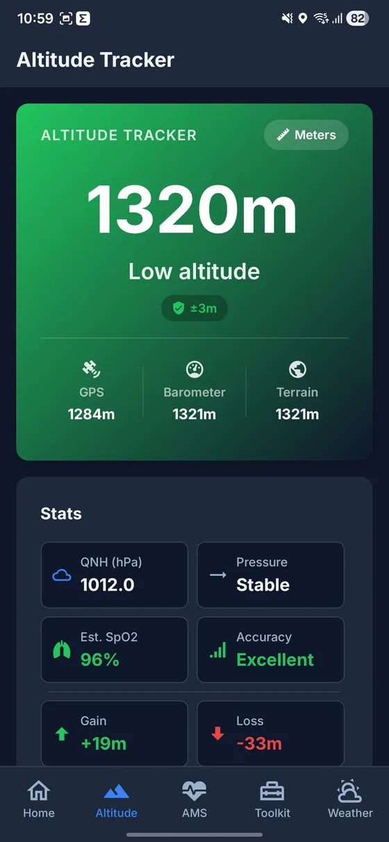
Real-Time Altitude Tracking
Blends GPS, barometer, and cached ground elevation (outlier rejection, geoid handling) for a steadier readout - offline when device sensors plus saved elevation points or manual calibration are available.
Weather Intelligence
Current conditions, hourly and 7-day outlook, trek safety verdicts, and altitude-adjusted temperatures - needs a recent network pull for fresh model data.
Trek Recording
Record a trek with live stats, background GPS (OS + battery limits apply), voice altitude nudges, route replay, and shareable summaries.
AMS Symptom Checker
Uses the common Lake Louise AMS questionnaire for self-assessment and logging - educational only, not a diagnosis and not a substitute for a medic.
Backtrack Navigation
Set an anchor point at your lodge or trailhead, then navigate back along your actual walked path with compass bearing, distance, and estimated time of arrival.
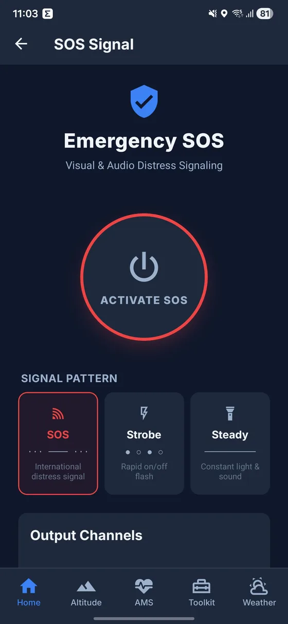
SOS & Emergency Tools
SOS flashlight patterns, speaker whistle tone, quick-dial saved contacts, and GPS location sharing via SMS - with an offline outbox that holds undeliverable texts until signal returns.
Interactive Map & Offline Packs
MapLibre map with OpenFreeMap vector tiles - no API key, no usage limits. Download any custom area you frame on the map, plus curated Nepal trek-region packs, for fully offline navigation. Import GPX for any mountain worldwide and follow it live.
Digital Compass
Full-featured digital compass with cardinal/intercardinal directions, GPS coordinates, live altitude display, and bearing-to-nearest-waypoint with turn guidance.
Trek Photo Camera
Capture trek photos automatically stamped with real-time altitude, GPS coordinates, date, time, and location name - creating a visual altitude diary of your journey.
Hydration Tracker
Track daily water intake with altitude-aware goals. Above ~3,000m dehydration sneaks up faster - this is a reminder, not individualized medical advice.
Gear Checklist
Interactive packing checklist covering clothing, gear, electronics, documents, first aid, water treatment, and extras - with season and altitude filters plus pack-weight totals to match your trek. Progress saves locally.
First Aid Guide
Comprehensive first aid guide covering common trekking emergencies - available offline when you need it most.
Waypoints System
Drop waypoints for camps, water sources, trail junctions, danger zones, and points of interest. Navigate to any saved waypoint with compass bearing.
Trek Planner & Itinerary Builder
Build detailed day-by-day itineraries with departure dates, daily stages, altitude profiles, and countdown timers on your home screen.
Metric & Imperial Units
Switch the whole app between metric and imperial in Settings - altitude, distance, speed, and pack weight all follow your choice. Emergency SMS coordinates and exported GPX always stay metric so rescuers and other apps read them correctly.
Achievement & Badge System
Earn badges for trekking milestones - first trek, altitude records, hydration streaks, gear preparation, and more. Share achievements with friends.
Trek History Backup
Export completed trek history as a private backup file - routes, stats, altitude profiles, and names included. Import on a new device with merge or replace. No cloud account required.
Under the hood
Engineering for extreme conditions
TrekGuard is built for cold phones, weak signal, and long days outside - not for demo-day Wi-Fi.
Altitude blending
GPS + barometer + cached ground elevation (not a pulse oximeter or medical device). Field accuracy depends on satellite fix, hardware, and calibration.
Offline Architecture
500-entry terrain elevation cache (7-day fresh TTL, up to 90 days when offline), plus downloadable MapLibre offline map packs - curated trek regions or any custom area you choose.
Privacy-first
No cloud account required. Route and trek data stay on-device until you export a backup file yourself. Analytics only when a release enables it - no ad monetization SDK in the default story.
Battery aware
Deferred writes, batched GPS points, and lighter animations so long days drain less battery - still depends on brightness, cold, and OS policies.
Important limitation
TrekGuard supports decisions. It does not replace local judgment.
GPX tracks, app notes, checklists, and route pages are planning aids. Weather, landslides, snow, trail changes, illness, lodge updates, official permit rules, guide advice, and local authorities should always override static app information.
Offline maps, GPS altimeter, weather, GPX, AMS checker, hike tracker
Compare TrekGuard to generic hiking apps: offline-first map regions, GPX import with route drift alerts, barometer-backed altitude, trek recording with elevation profiles, trek history export/import for new phones, Lake Louise AMS logging (educational only), Morse SOS flashlight, and contacts you configure - not a pre-loaded rescue directory.
Fresh mountain weather and map downloads need connectivity once. Core navigation and safety tools work after setup when mobile data drops on Himalayan, Alpine, Andean, or any high backcountry trail.
Get it on Google Play
Ready for your next Nepal & mountain adventure?
Download map packs on Wi‑Fi, pull weather while online, then use GPS altitude, planner & safety tools on trail - free on Google Play. Not a guide or rescue service.