Your high-altitude safety companion
Real-time altitude, weather, trek recording, SOS tools, and maps — strongest Nepal route library, with tools for treks worldwide. Supports safer decisions; you still decide when to turn around.
15+
Safety tools
10+
Nepal routes
100%
Free & Open
App preview
See TrekGuard in action
Screens built for quick field checks — altitude, weather (when cached or online), maps, and emergency prep tools.
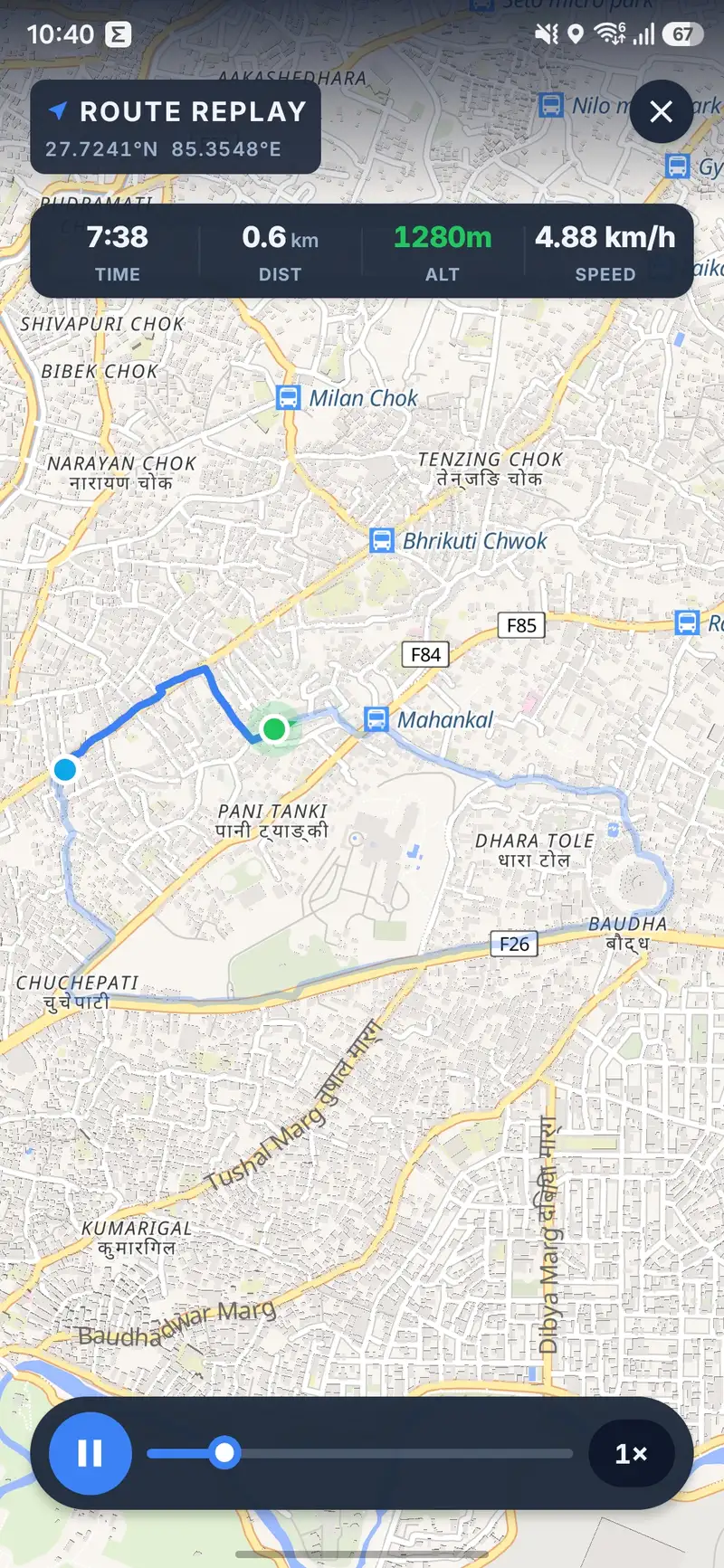
Replay your trek
Scrub the timeline over real map tiles — altitude, pace, position.
App features
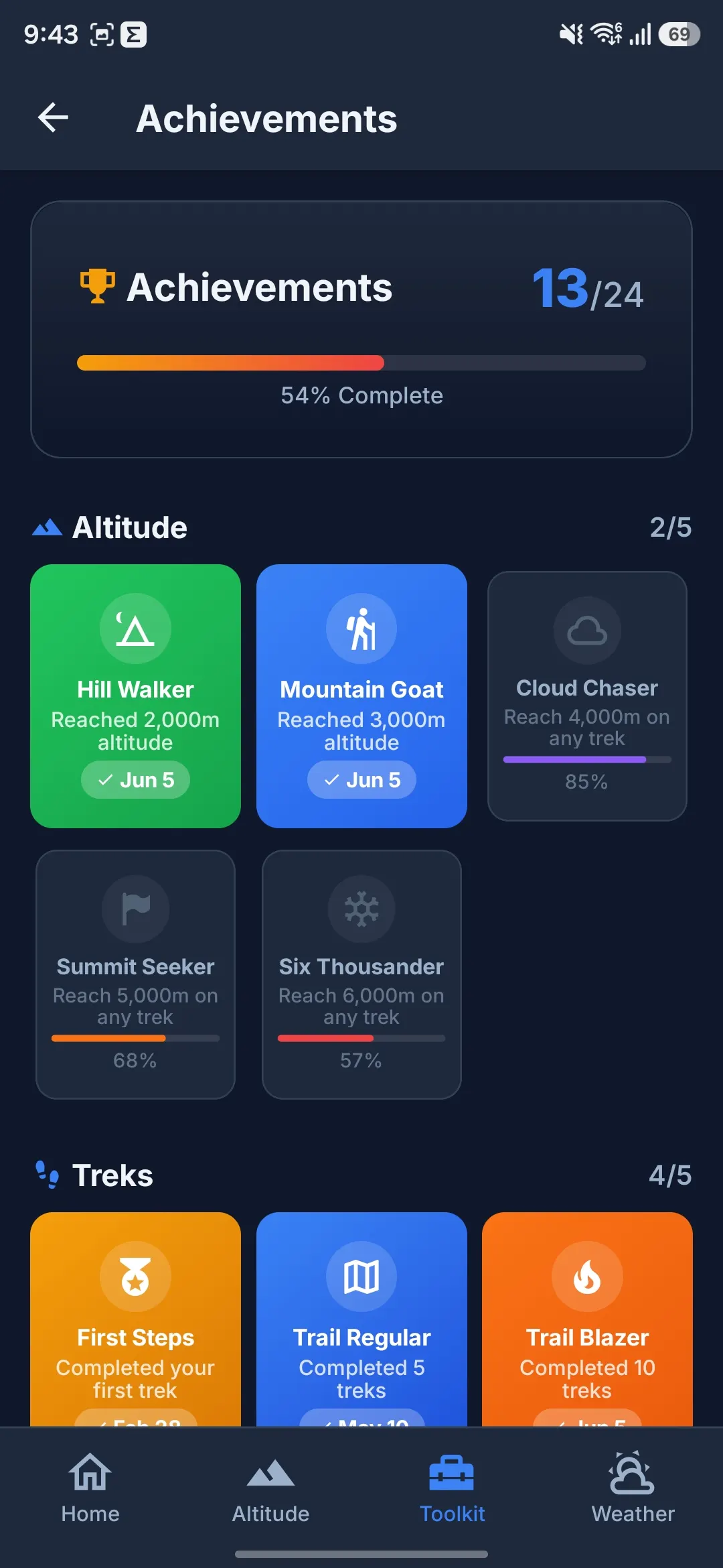
15+ safety tools built for real mountain conditions.
Altitude, weather, maps, recording, and SOS-style tools — built to support your judgment on the trail. Not a substitute for guides, weather on the ground, or rescue services.
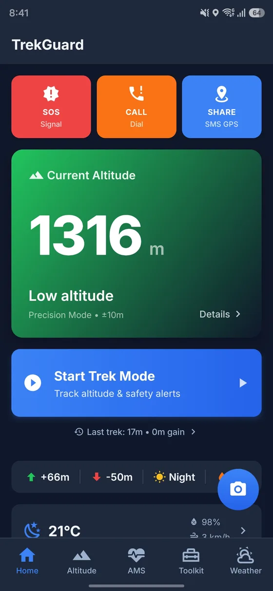
Real-Time Altitude
GPS + barometer + cached map elevation anchors for steadier altitude readouts across 5 altitude zones.
Weather Intelligence
Hourly and 7-day forecasts, trek safety verdicts, UV, freezing level — fresh data needs connectivity; brief cache when offline.
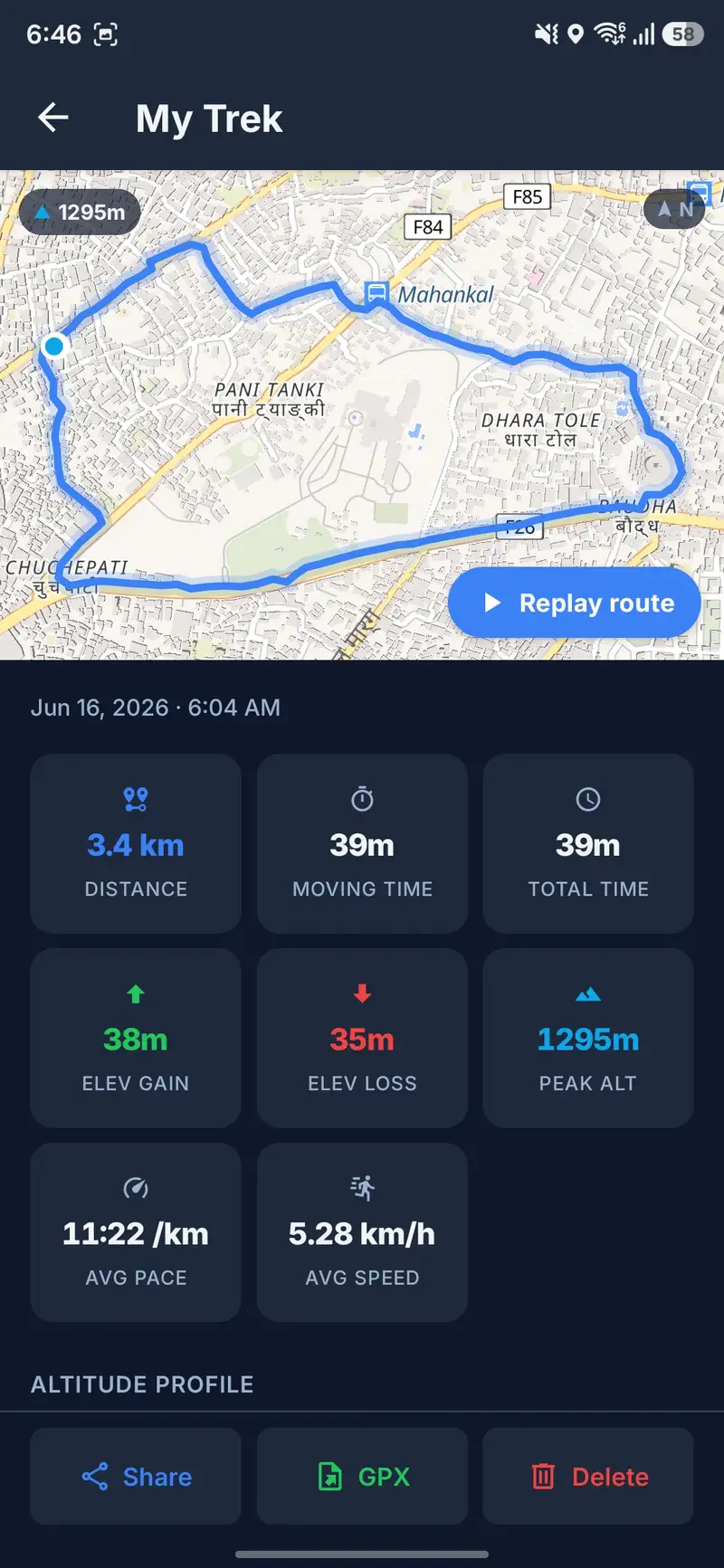
Trek Recording
GPS trek recording with live stats, elevation profiles, voice alerts, and shareable activity summaries.
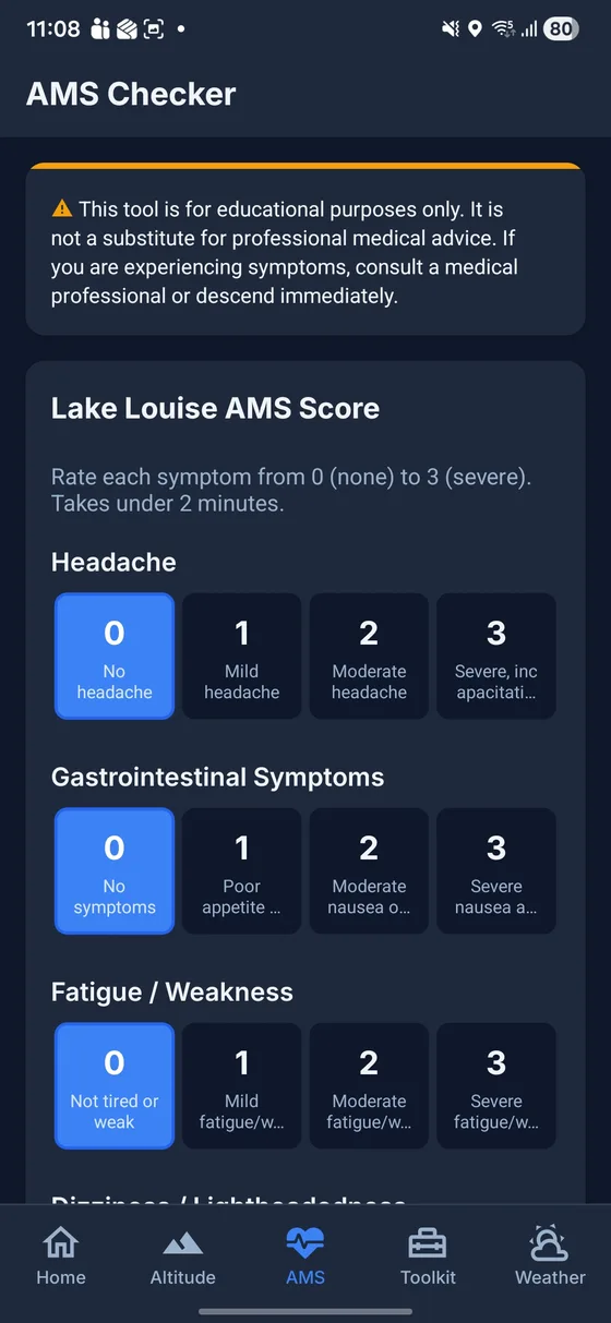
AMS Checker
Lake Louise–style symptom self-check and history — educational only, not a diagnosis.
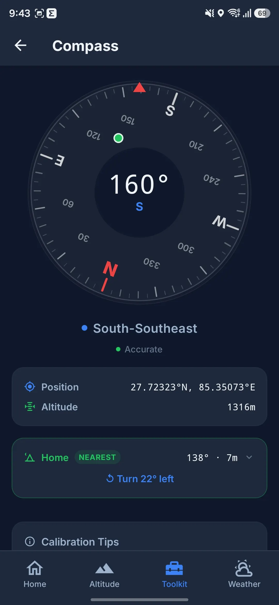
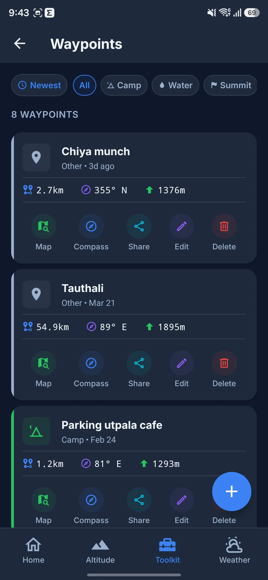
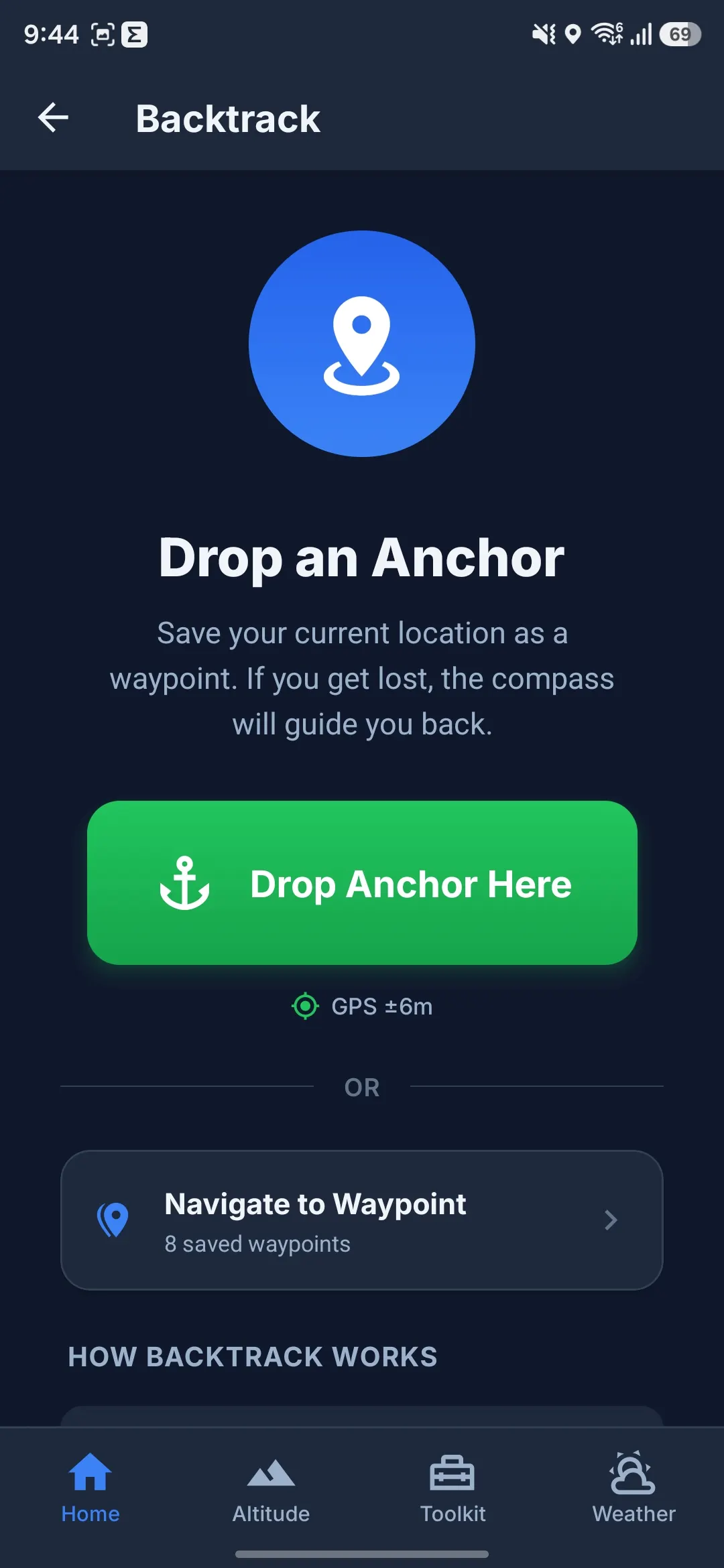
Backtrack Navigation
Compass-guided return along your walked path; ETA from your recorded pace (estimate, not rescue timing).
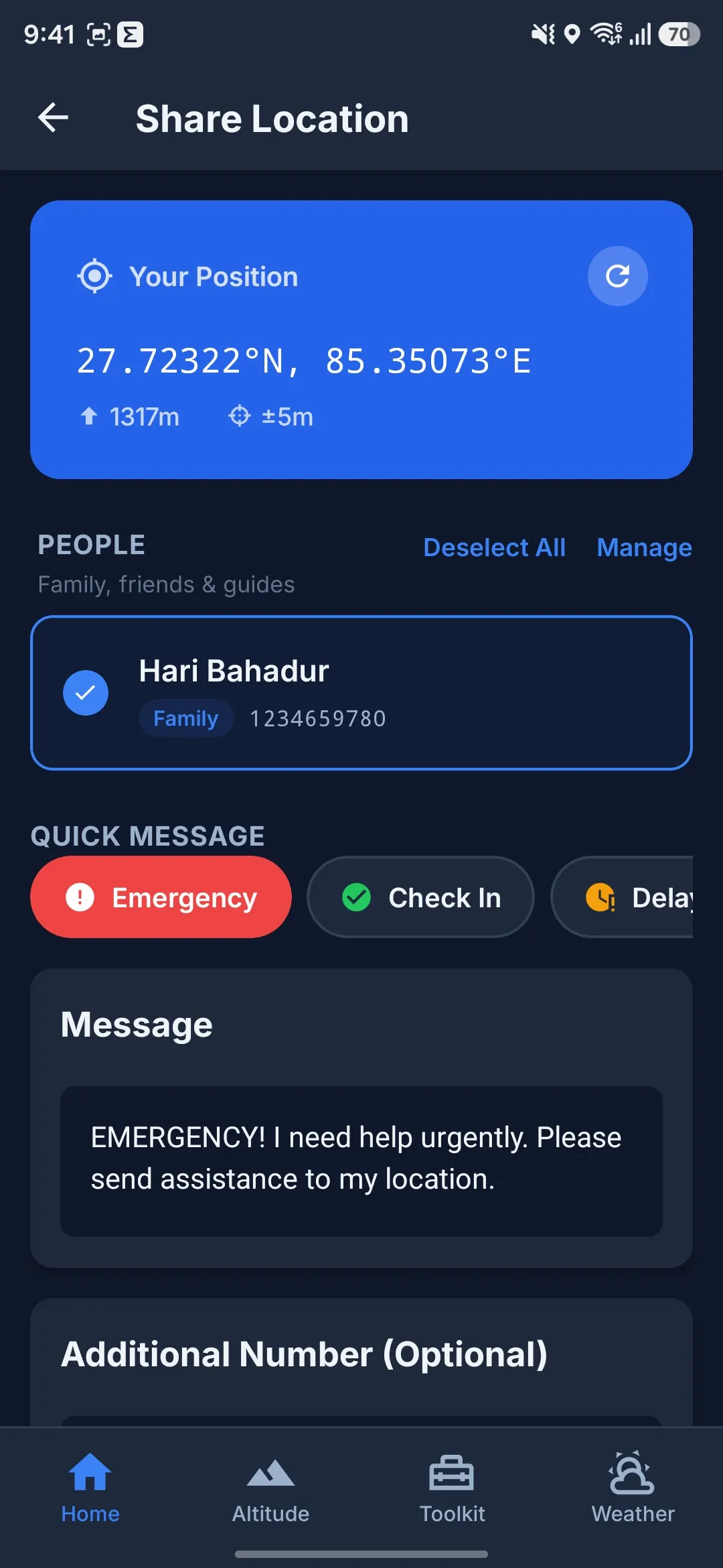
SOS & Emergency
Morse SOS flashlight, speaker whistle, quick-dial saved contacts, SMS GPS share with an offline outbox that retries when signal returns.
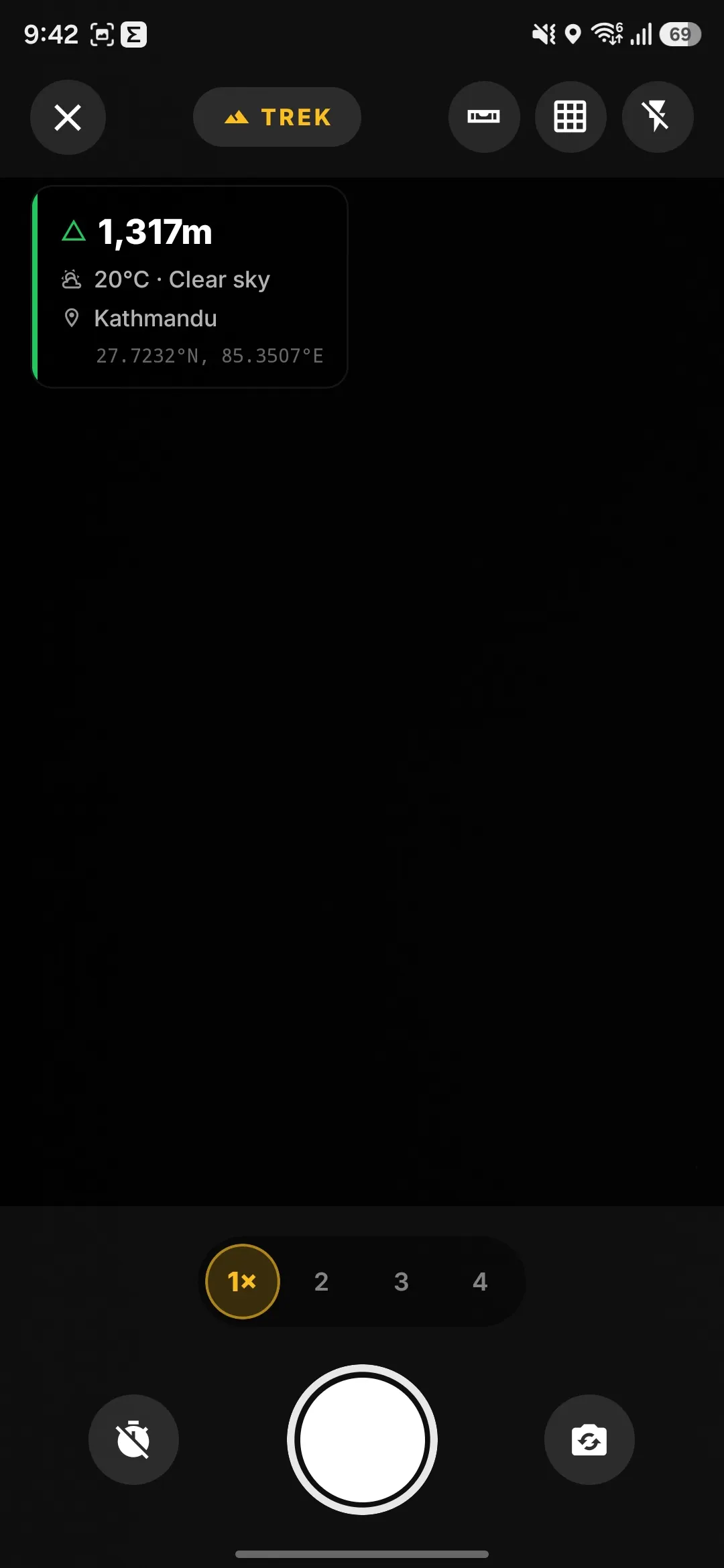
Trek Photo Camera
Capture photos stamped with real-time altitude, GPS coordinates, and trek metadata overlay.
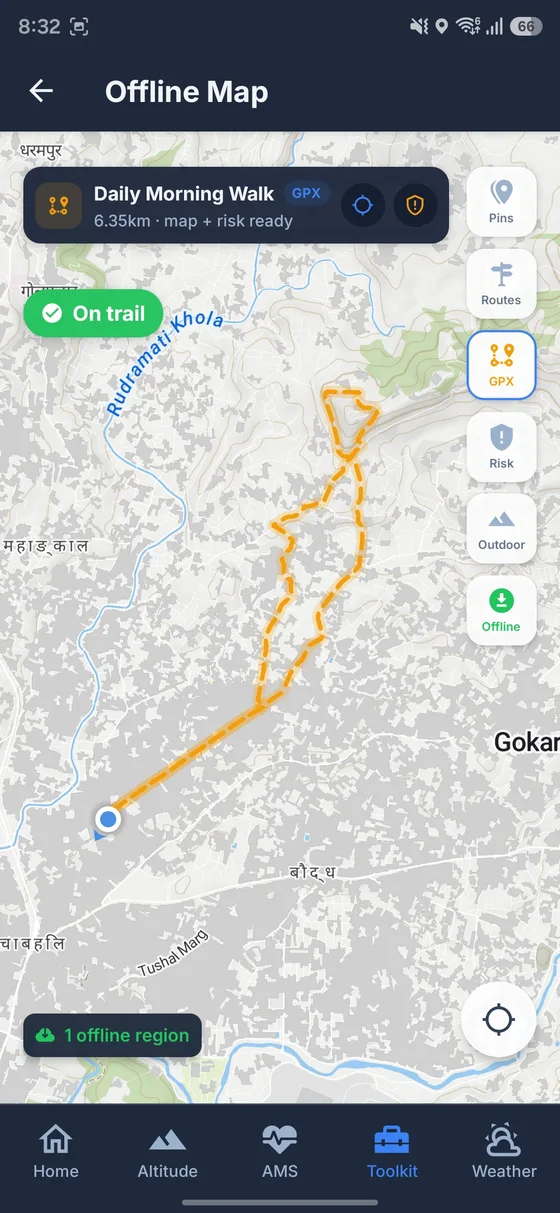
Interactive Map
MapLibre outdoor tiles, downloadable offline regions, waypoints, and GPX route-following with off-trail alerts and ETA.
Steadier altitude readouts in the field.
TrekGuard blends GPS, barometer, and cached map elevation so your altitude readout stays steadier — including offline when you have a recent terrain cache or manual calibration.
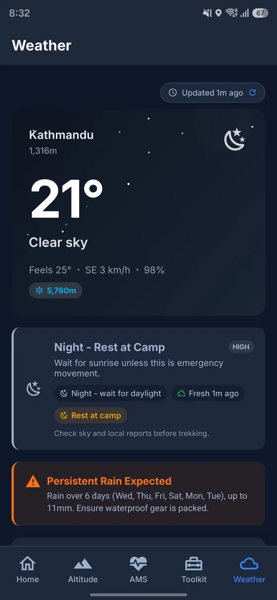
Mountain-focused forecasts for your elevation.
Hourly and 7-day forecasts, trek safety verdicts, and altitude-adjusted temperatures — pull fresh data online; stale cache only when offline.
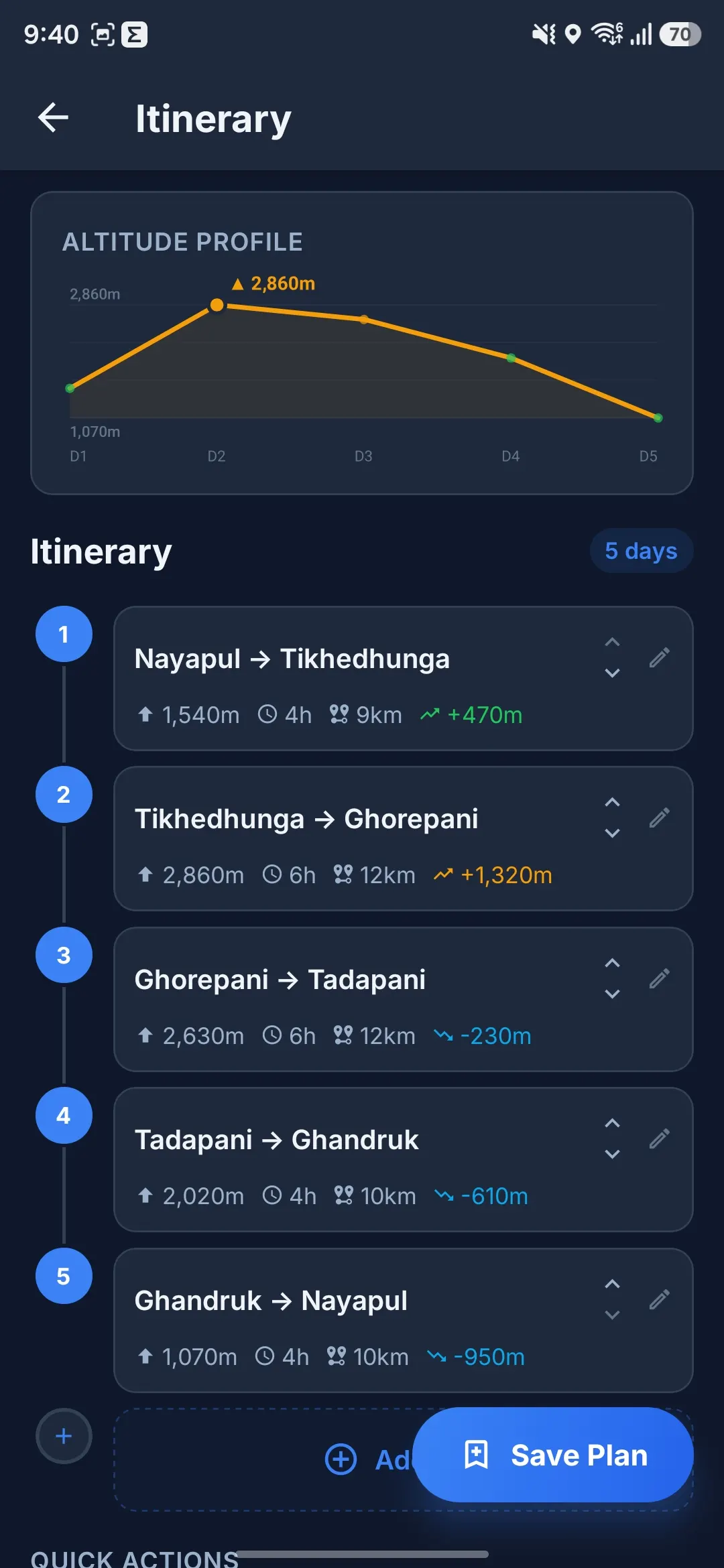
Track every step of your journey.
GPS trek recording with live stats, route line on the map, voice altitude alerts, and shareable summaries — tracking continues in the background with OS limits and battery tradeoffs.
Safety toolkit
Safety tools for when conditions turn.
Flashlight SOS patterns, AMS self-check, backtrack, first aid notes, hydration nudges, and SMS coords — core flows work offline; SMS still needs cellular service.
SOS Flashlight Signals
Morse SOS pattern on your phone flashlight — visibility depends on battery, weather, and distance.
AMS Symptom Checker
Lake Louise scoring with severity bands, estimated SpO₂ ranges by altitude (not a pulse oximeter), and symptom history.
Backtrack Navigation
Compass-guided return along your actual walked path. Reversed trail routing with live distance and ETA.
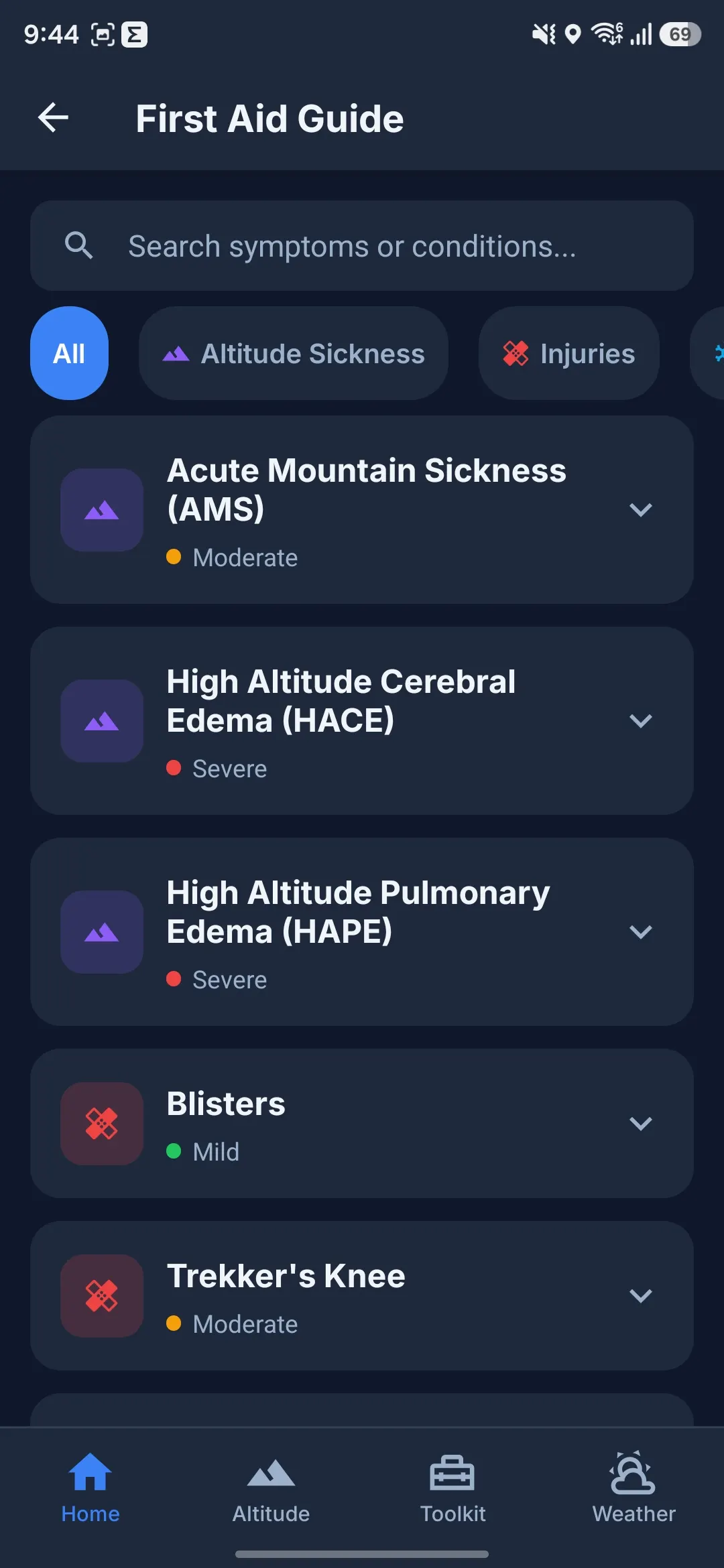
First Aid Guide
Offline emergency medical reference covering frostbite, hypothermia, fractures, AMS, and snake bites.
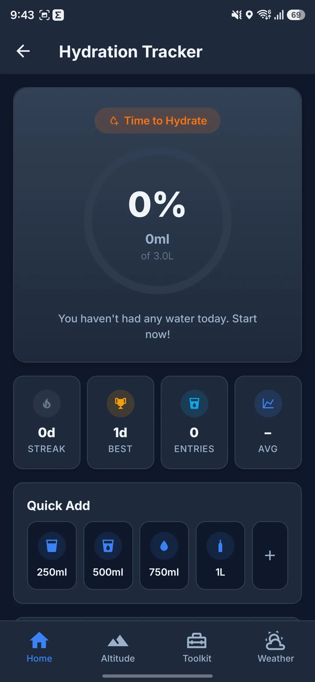
Hydration Tracker
Altitude-adjusted daily water goals with reminders — hydration helps recovery; not a substitute for descent if AMS symptoms appear.
SMS Location Sharing
Share GPS coordinates by SMS with one tap. If a text can't send, an offline outbox holds it and prompts a retry when signal returns — not a satellite messenger.
Popular treks
Nepal trek routes — GPX + guides
Nepal trek guides and GPX on this site — EBC, Annapurna, Langtang, and more. Same app imports your GPX for Alps, Rockies, Andes, and other peaks.

Ama Yangri Trek
A short and accessible trek in the Helambu region offering 360° views of Langtang, Ganesh Himal, Jugal Himal, and Dorje Lakpa from the summit of Ama Yangri at 3,771m. Rich in Hyolmo and Tamang culture.

Khopra Danda Trek
An off-the-beaten-path trek with stunning close-up views of Dhaulagiri, Annapurna South, and the sacred Khayer Lake. Far fewer crowds than Poon Hill.

Annapurna Base Camp Trek
A stunning trek into the Annapurna Sanctuary — a natural amphitheatre surrounded by towering peaks including Annapurna I (8,091m) and Machhapuchhre (6,993m).

Gosaikunda Trek
Trek to the sacred Gosaikunda Lake (4,380m), a holy Hindu pilgrimage site surrounded by 108 alpine lakes. Stunning views of Langtang and Ganesh Himal ranges. Popular during the Janai Purnima festival.

Mardi Himal Trek
A spectacular ridgeline trek offering intimate views of Machhapuchhre (Fishtail), Annapurna South, and Mardi Himal. The trail follows a narrow ridge with dramatic drop-offs on both sides, culminating at Base Camp (4,500m).

Everest Base Camp Trek
The iconic trek to the foot of the world's highest peak. Follow the Dudh Koshi river through Sherpa villages, monasteries, and glacial moraines to Everest Base Camp at 5,364m.
Why TrekGuard
Built different. Built for real conditions.
Offline-first hiking GPS built for Nepal Himalaya — EBC, Annapurna, Langtang, and more. Same altitude, weather, and safety tools on Alps, Rockies, Andes, and backcountry after setup.
Privacy-first
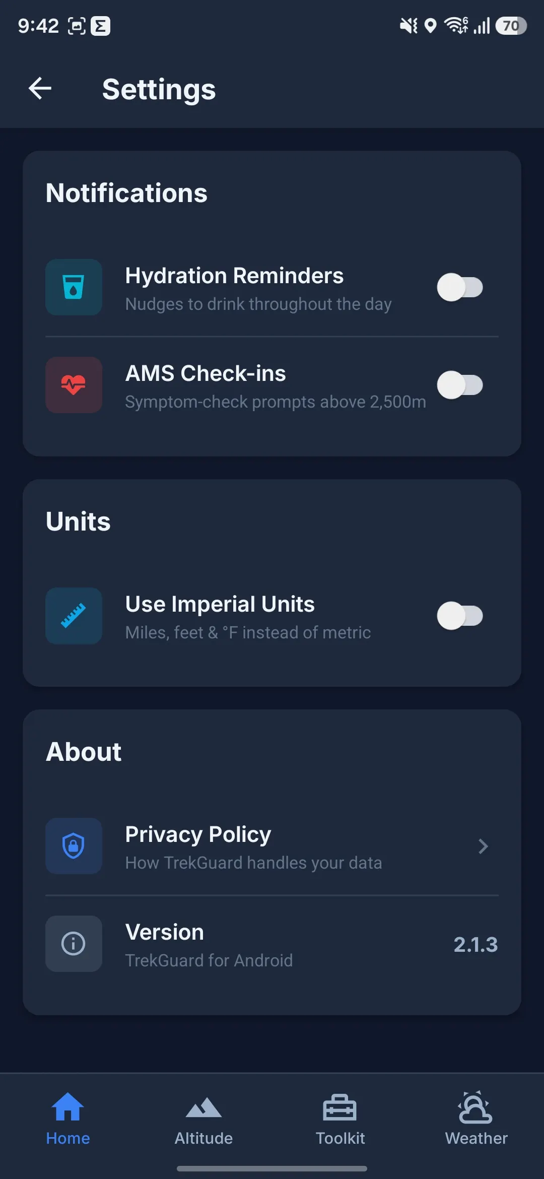
No cloud login. Core trek data stays on your device. Play build has no ad SDK; optional analytics only when a release enables it.
Offline after setup
Map packs, GPX, altitude, compass, recording, checklists & first aid work offline once downloaded — pull weather and tile updates while you still have data.
No subscription
Published app includes the full toolset — no tiered paywall in the Play release we ship.
Lightweight & fast
Tuned for long days outside — actual battery life still depends on cold, brightness, and how you use GPS.
Planning aid — not a guide or rescue service. GPX lines, checklists, forecasts, and altitude readouts support your judgment. Trails, weather, permits, and illness can change faster than any app. Download offline map packs before signal ends; live map tiles and fresh weather need network. SMS SOS sharing needs cellular texting — not satellite.
Free Nepal trekking app — also works on mountains worldwide
This is the official TrekGuard website. TrekGuard is an Android hiking GPS app for weak signal: download offline map packs on Wi‑Fi, import GPX tracks, pull mountain weather while online, track altitude with GPS and barometer, plan multi-day itineraries, and use AMS self-check plus SOS tools before you leave town.
Deep Nepal content covers Everest Base Camp (EBC), Annapurna Circuit, Annapurna Base Camp (ABC), Langtang, Manaslu, Mardi Himal, Mustang, and more — with free GPX downloads on this site. You can also build custom treks for the Alps, Rockies, Andes, and other backcountry trails.
TrekGuard is free with no subscription. It supports your decisions — not guides, rescue services, or on-the-ground weather.
Common questions
Quick answers before you download — offline maps, Nepal & worldwide treks, pricing, and safety limits. All 45 FAQs on Support.
What is TrekGuard?
TrekGuard is a free Android hiking and trekking app for offline map packs, mountain weather, GPS/barometer altitude, multi-day trek planning, GPX import, backtrack navigation, Lake Louise AMS self-check, and SOS-style tools. Nepal routes (EBC, Annapurna, Langtang, Manaslu, and more) are built in; you can also plan custom treks worldwide.
Is TrekGuard free? Is there a subscription?
The Play release we ship is free with no in-app subscription tier. No ad SDK in the default build.
Where do I download TrekGuard?
Get the app on Google Play: search TrekGuard or open the Play Store link from this site. Install before your trek so you can download map packs and GPX while you still have Wi‑Fi.
Does TrekGuard work offline?
Many core tools work without mobile data after setup: altitude, compass, backtrack, trek recording, first aid, gear checklists, saved emergency contacts, and imported GPX on downloaded maps. Weather needs a recent online fetch (short cache when offline). Live map tiles require downloading an offline area first. SMS sharing needs connectivity.
Does TrekGuard work outside Nepal?
Yes. Nepal has the deepest templates and offline map regions, but worldwide custom treks, GPX import, altimeter, weather, AMS tools, and recording work on Alps, Rockies, Andes, Patagonia, and other mountain trails.
Does TrekGuard replace a guide, porter, or local advice?
No. TrekGuard is a preparation and field companion. Weather on the ground, lodge reports, official rules, licensed guides, and rescue services always come first.
Does TrekGuard include rescue phone numbers?
No pre-loaded rescue directory. You add personal contacts and local service entries (police, ambulance, rescue, hospital) or import from your phone. Set these up before the trail.
Does TrekGuard measure blood oxygen (SpO₂)?
No. The app shows estimated SpO₂ ranges by altitude for education only — not pulse-oximeter readings and not medical advice. Use proper devices and professionals for health decisions.
TrekGuard does not replace guides, rescue, or medical care
Get it on Google Play
Ready for your next Nepal & mountain adventure?
Download map packs on Wi‑Fi, pull weather while online, then use GPS altitude, planner & safety tools on trail — free on Google Play. Not a guide or rescue service.